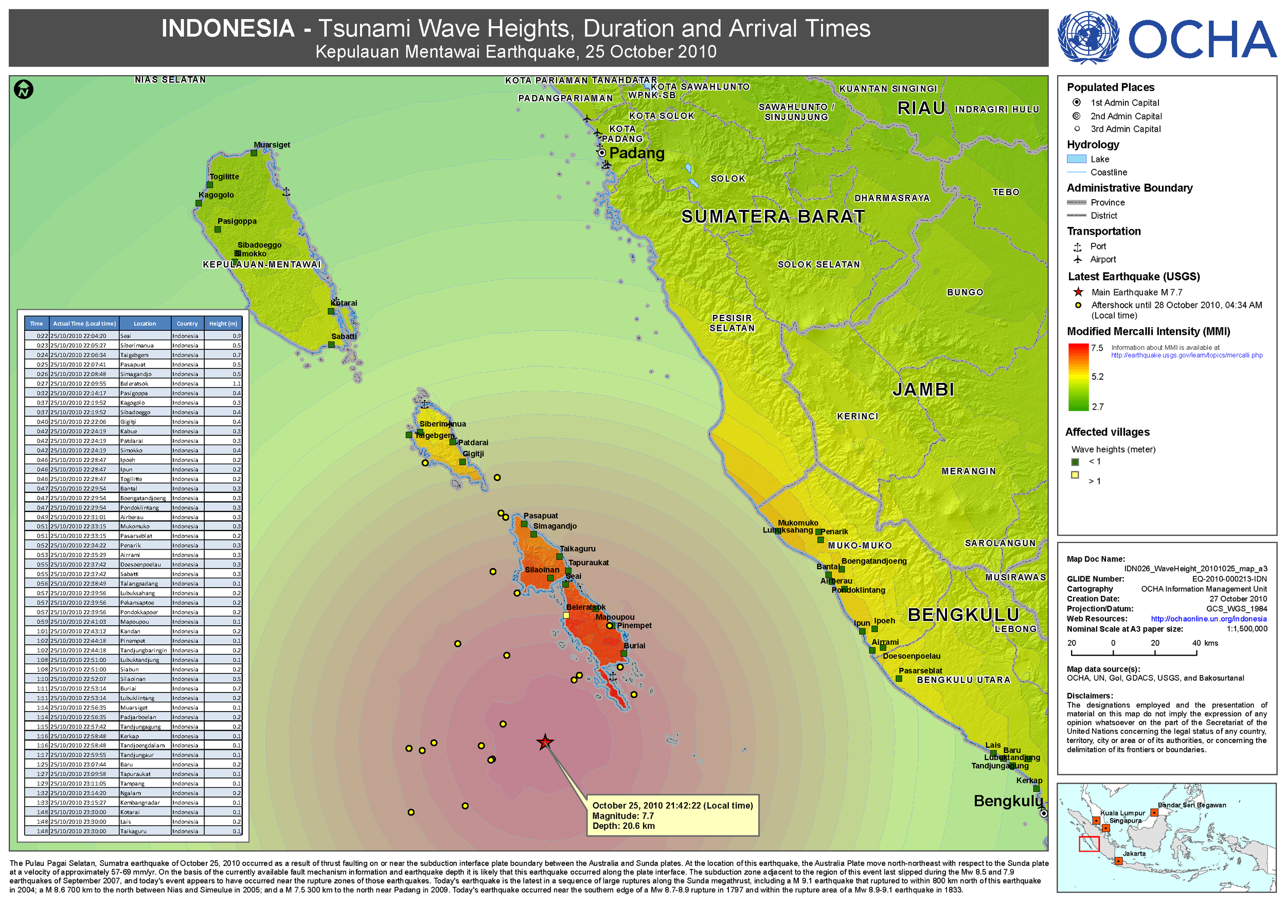
2010 Mentawai Tsunami and Earthquake
25 October 2010 - 21:42, that night I was in my room (Agus Salim stadium complex) working on map requested by Ignacio Leon - Head of OCHA Indonesia. He asked me to create some infographic about each natural disaster and it’s impact in Indonesia.
When the shock occurs, I grab my go-bag and bicycle and spur fast towards Alai Market. But unfortunately traffic jam and extreme panic had occurred when I passed Padang Baru intersection.
Then, the day after was a very busy day for me and team, coordinating data, analysis and information management to support the response. For first action, I create disaster event and general information map using the best available data that I can found from internet, to help government counterpart and humanitarian actors understand on the situation.
Disaster event map
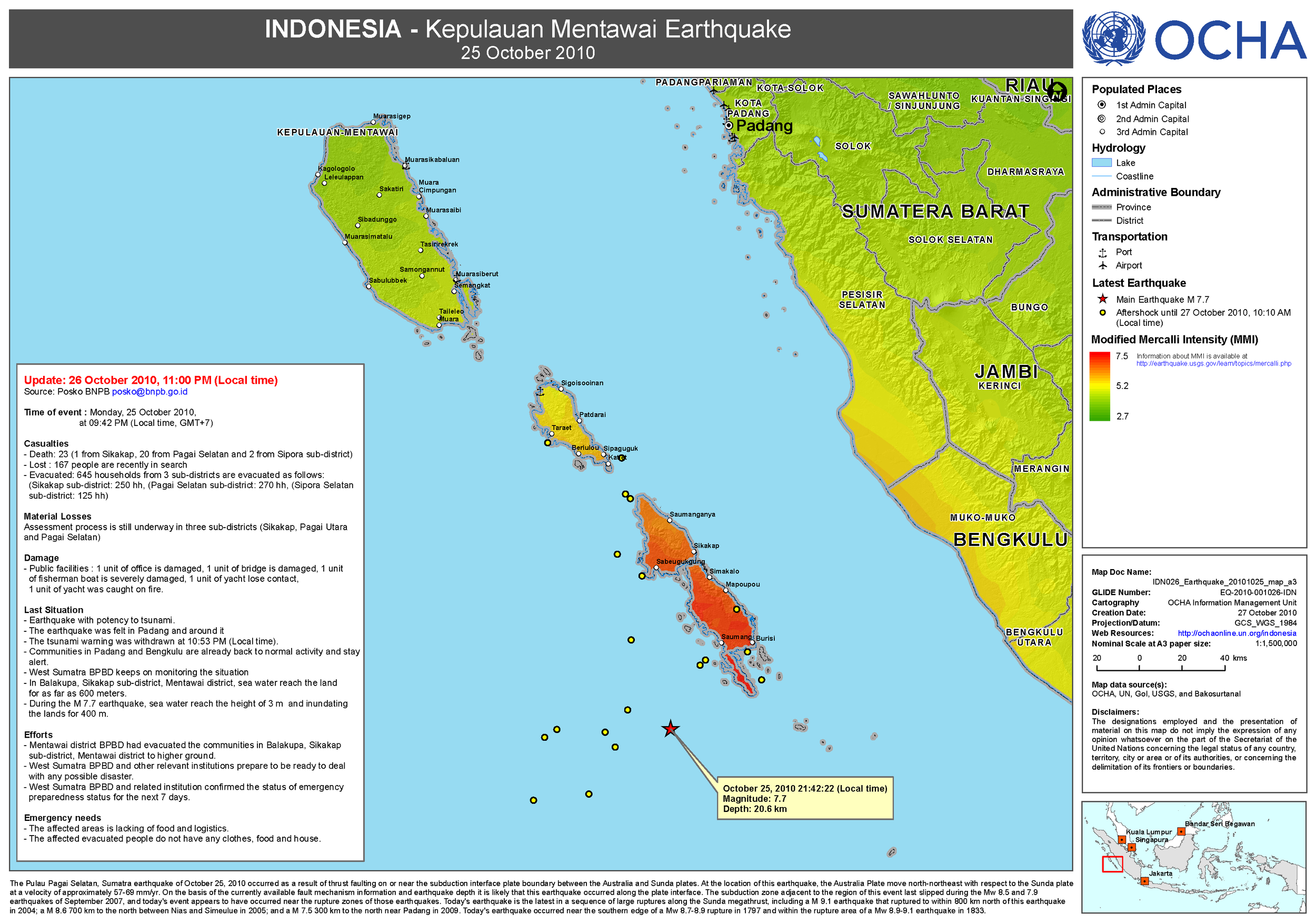
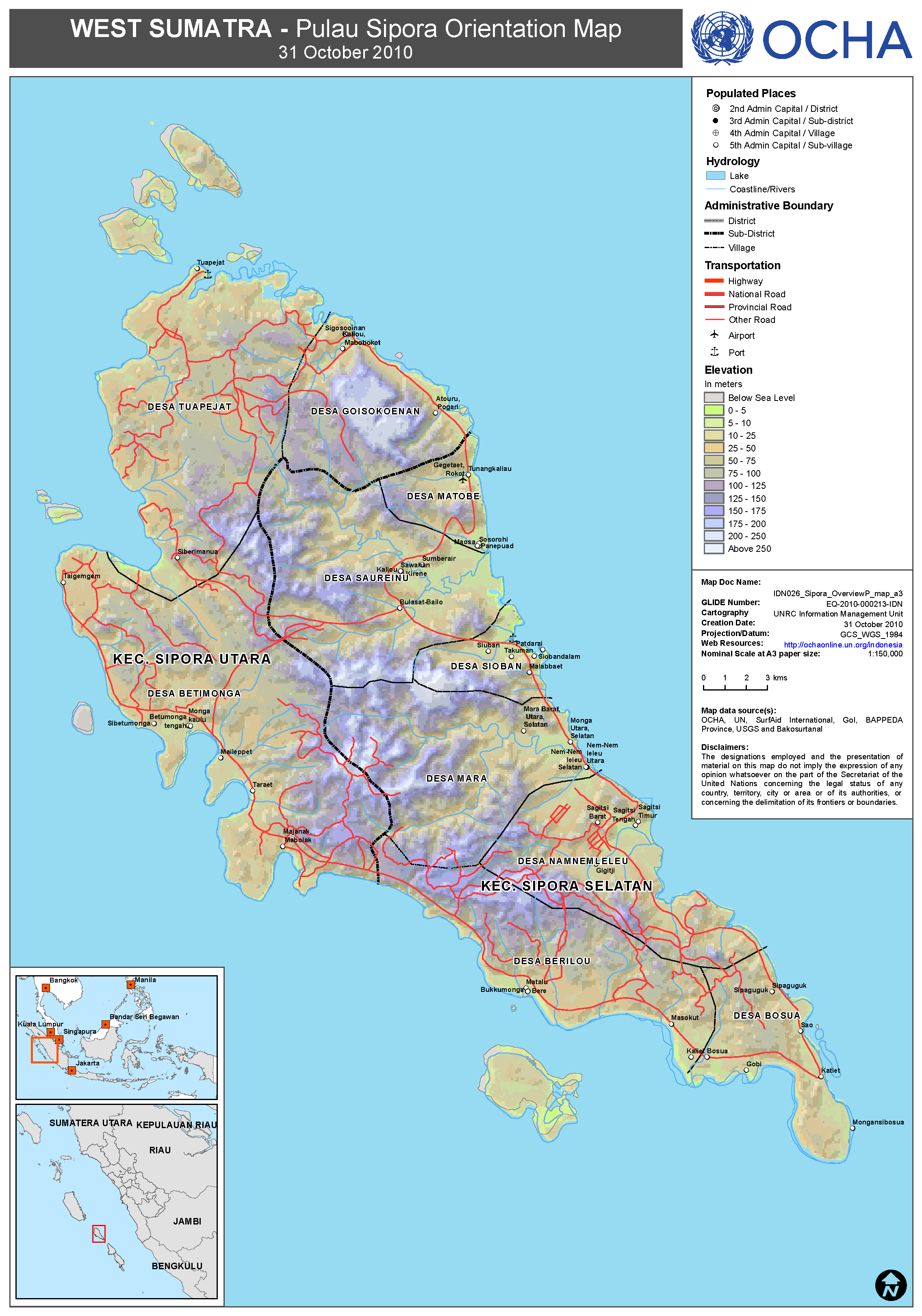
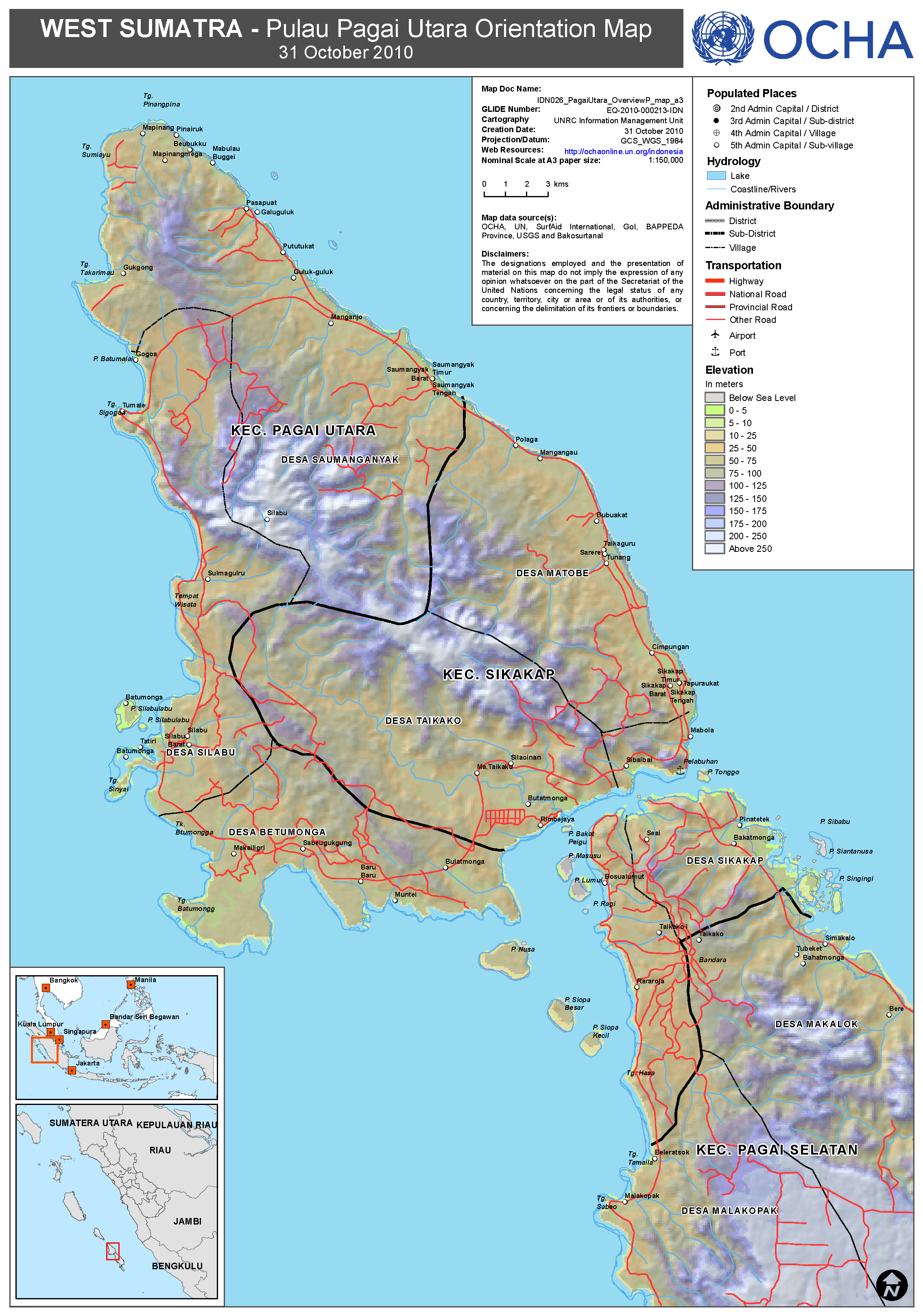
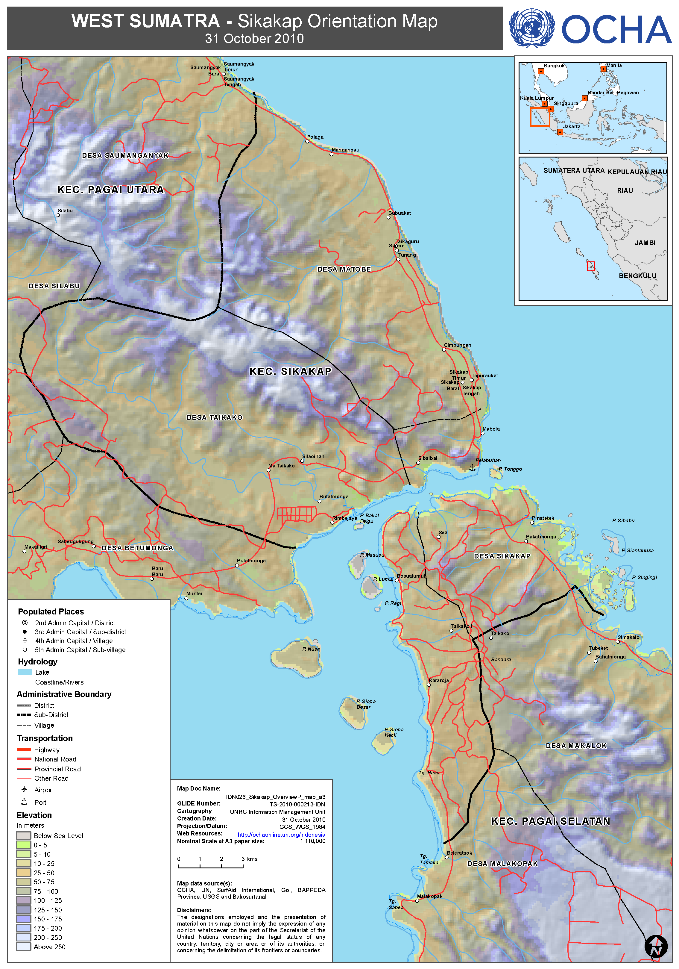
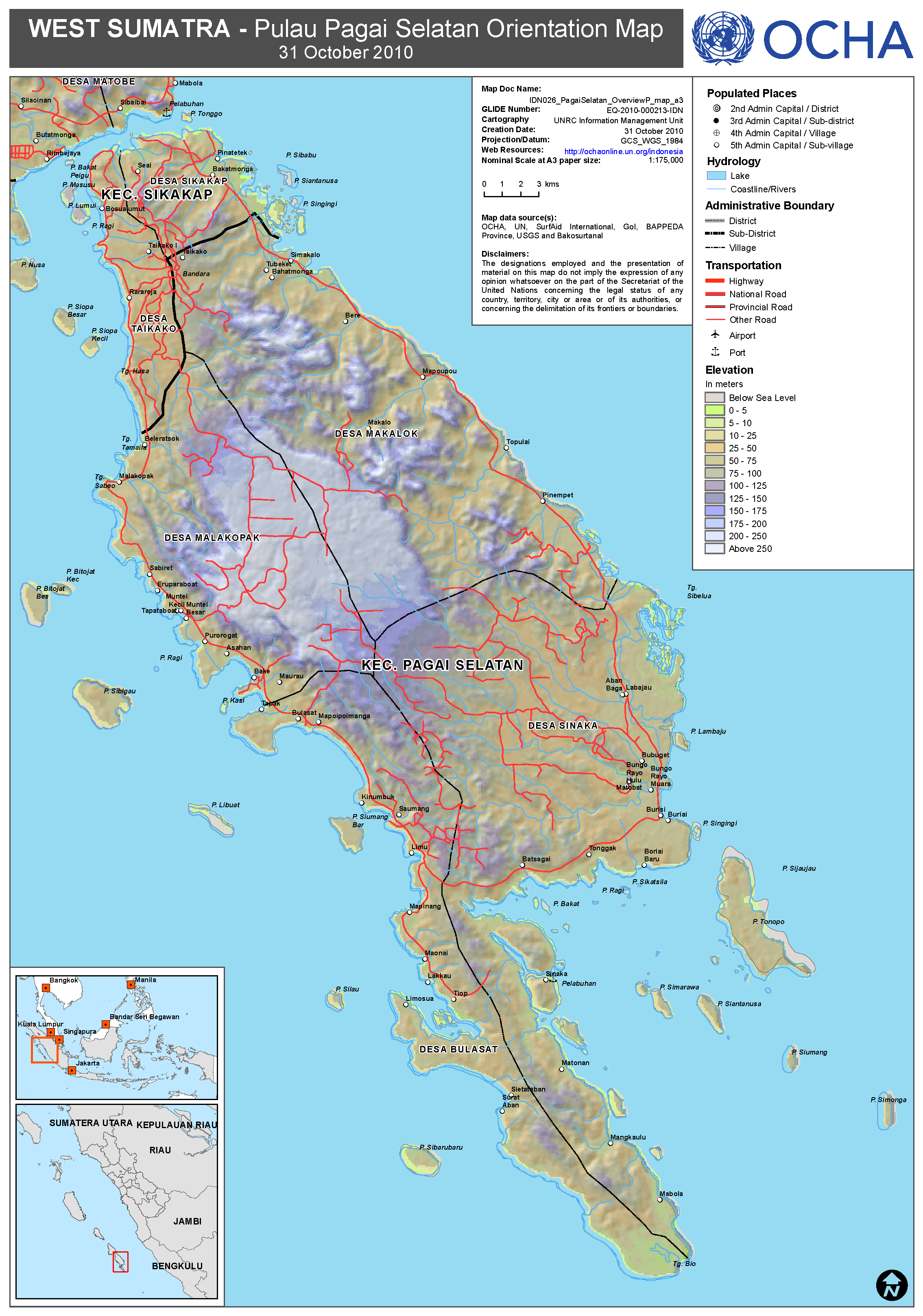
General administration map