So fun Aerial Bold!
Remote Sensing
General
Aerial Bold, a project that scours satellite imagery for the human-built letters of the world and turns them into a usable font
Have you heard about Aerial Bold? - a project from Benedikt Groß & Joey Lee, devoted to finding all the human-built letters of the world. The idea was to pore over satellite imagery to locate architectural ABCs, then turn those images into a font. Wired also discussed this.
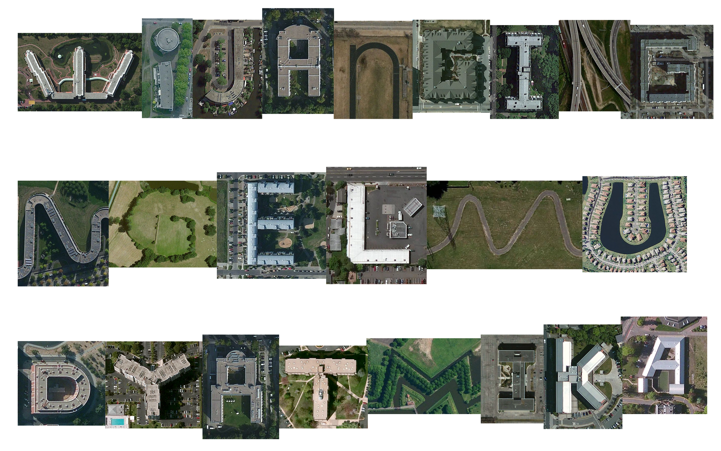
Here’s the example of my daughter’s name using Aerial Bold. If you are curious, yes it’s real, W letter in the picture comes from Rosenhof Berlin-Zehlendorf Seniorenwohnanlage Betriebsgesellschaft mbH, Schlettstadter Straße 22, 14169 Berlin, Germany. https://maps.app.goo.gl/TYBs856cSeDM9imz9
Back to top