Food accessibility for Rohingya refugees
Following my visit to Rohingya camps in Cox’s Bazaar - Bangladesh two-months ago, I try to apply accessibility modeling to help understand on how well covered is Kutupalong megacamp in terms of WFPs services and how efficiently their food distribution points can reach refugees.
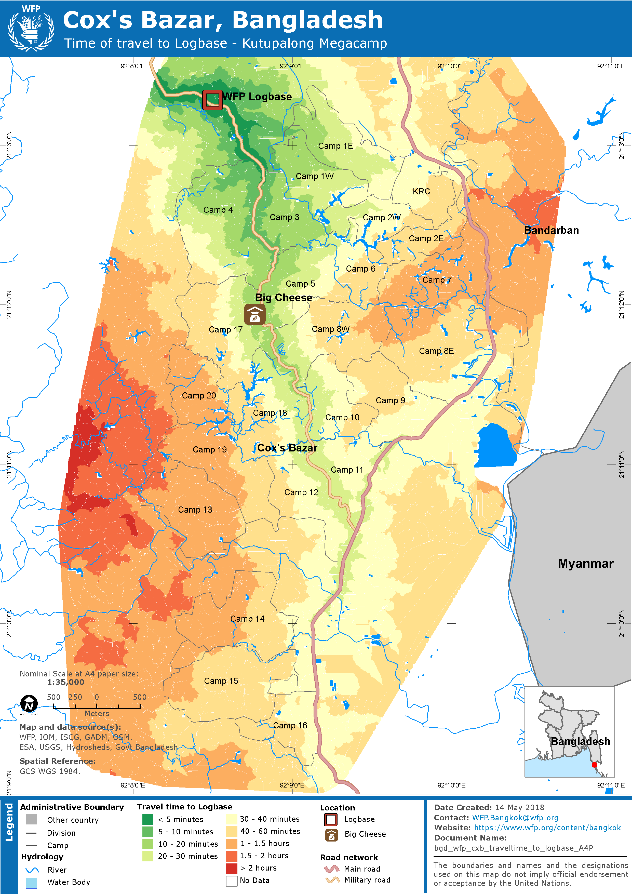
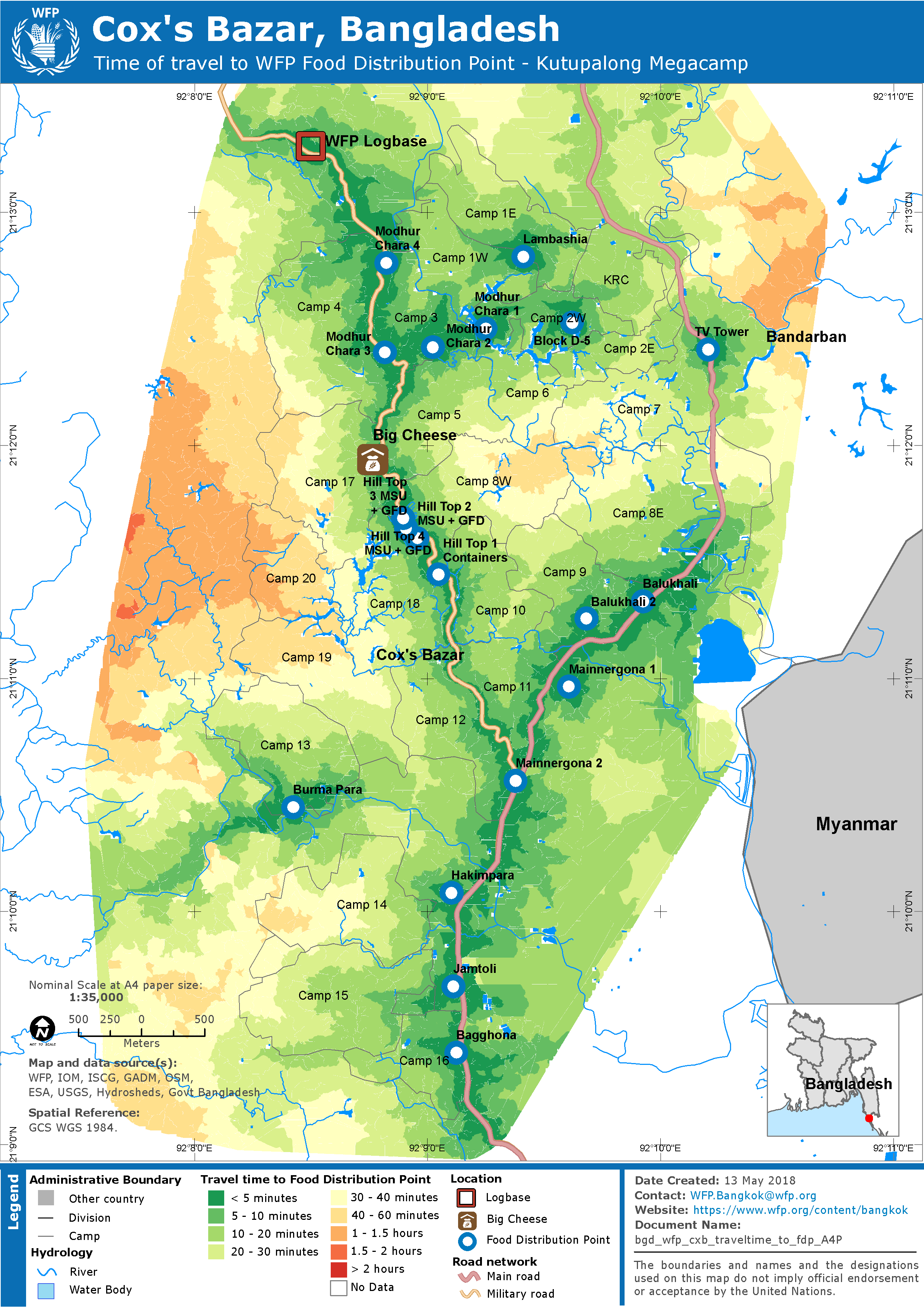
As a first draft, below maps provides information on accessibility (travel time and catchment area) to WFP facilities: Food Distribution Point, LogBase, eVoucher shop, BSFP/TSFP. It estimates (at each pixel) the time it takes to travel to the nearest location of WFP facilities with key assumption: mixed transportation mode - by foot until road then vehicle.
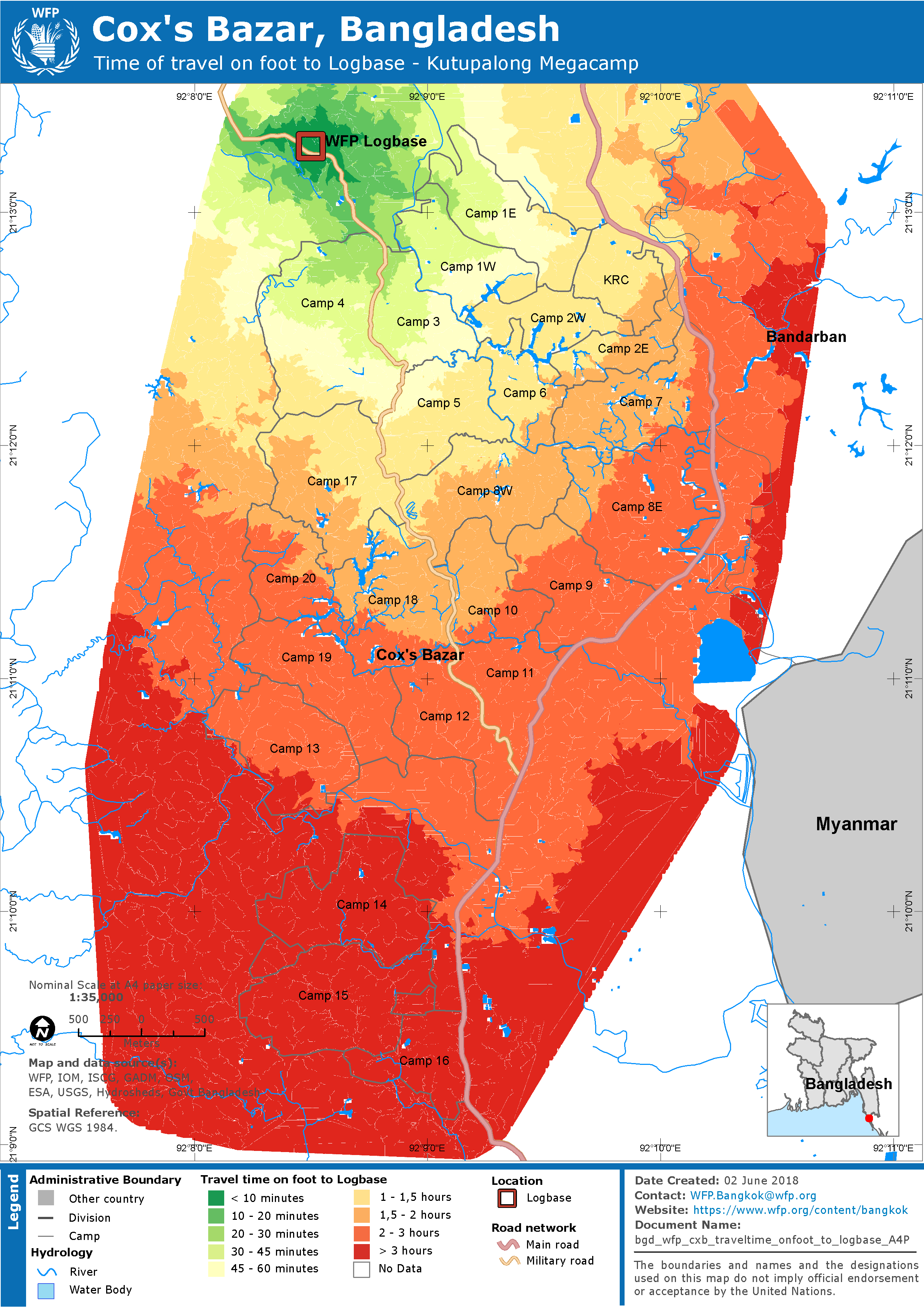
After having few discussion with team in the field, seems the mix transportation premise is not realistic for Kutupalong megacamp, and they would like to have walking-distance only maps, even on main roads. This will allow WFP to plan for the porter system for the Logbase, clinics, food and evouchers distribution points, as well as the areas that are less well covered by the current points.
I revised the maps based on their feedback, see below.
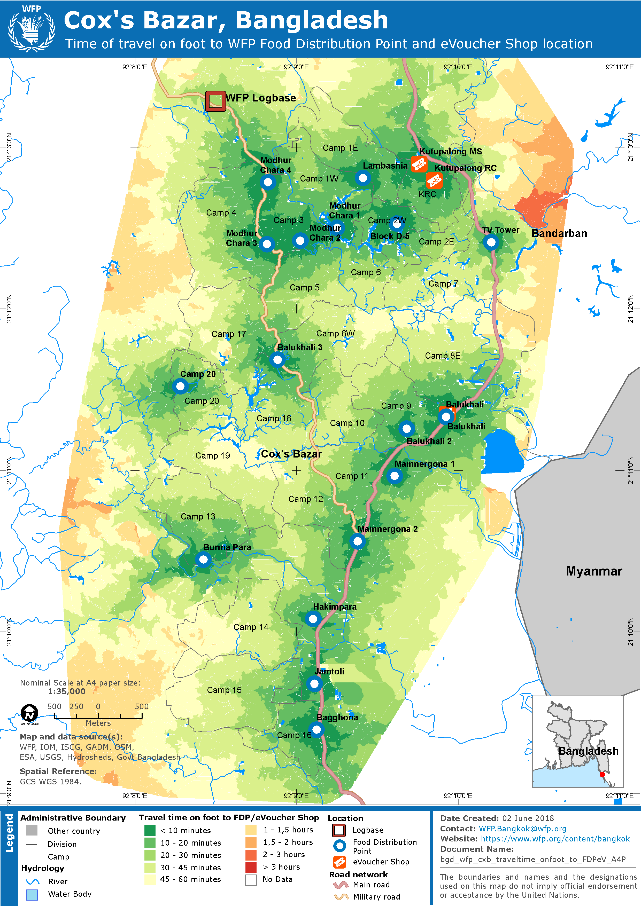
Below is an example on how GIS can support WFP to determine the best location for food distribution point, improved supply chain and better serve refuges.
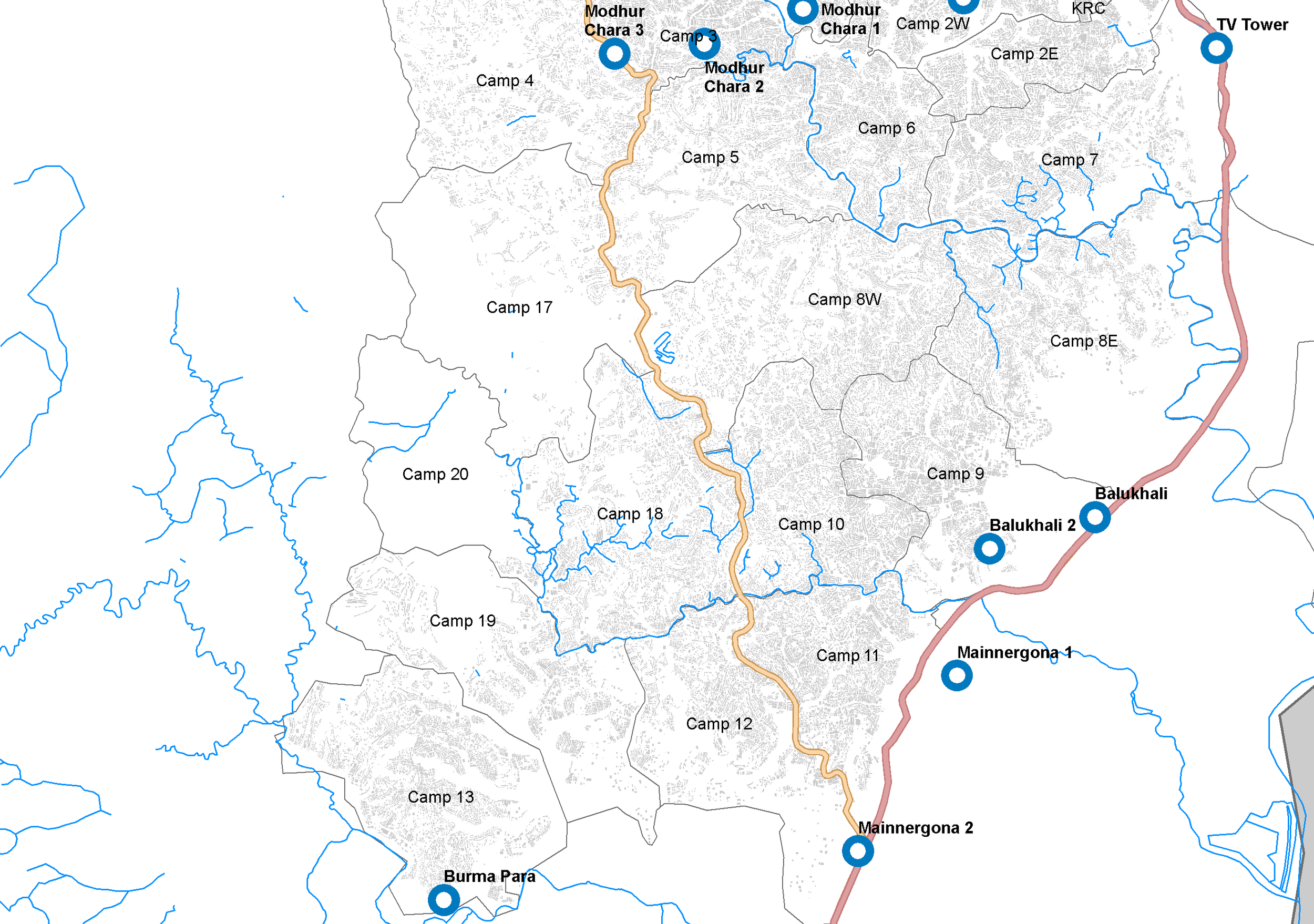
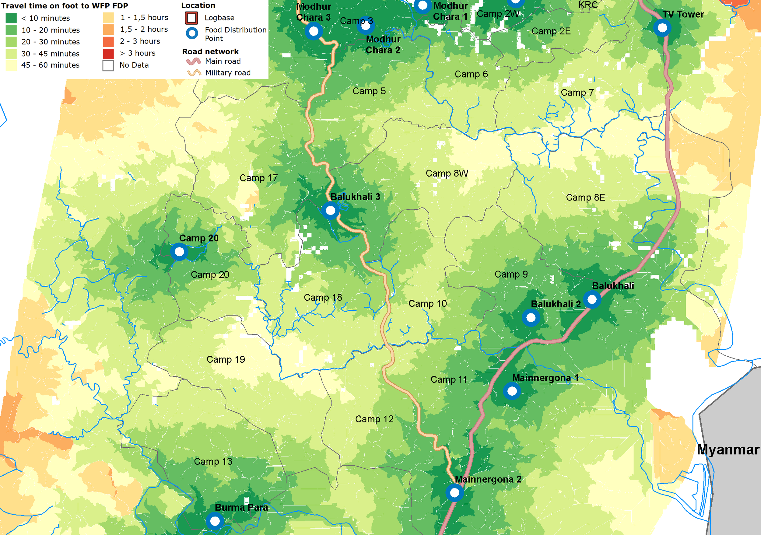
- Initial location of WFP food distribution point (FDP) at the western part of Kutupalong megacamp
- Travel time (on foot) is analysed based on accessibility model to identify how long Rohingya refugees are able to reach the nearest FDP.
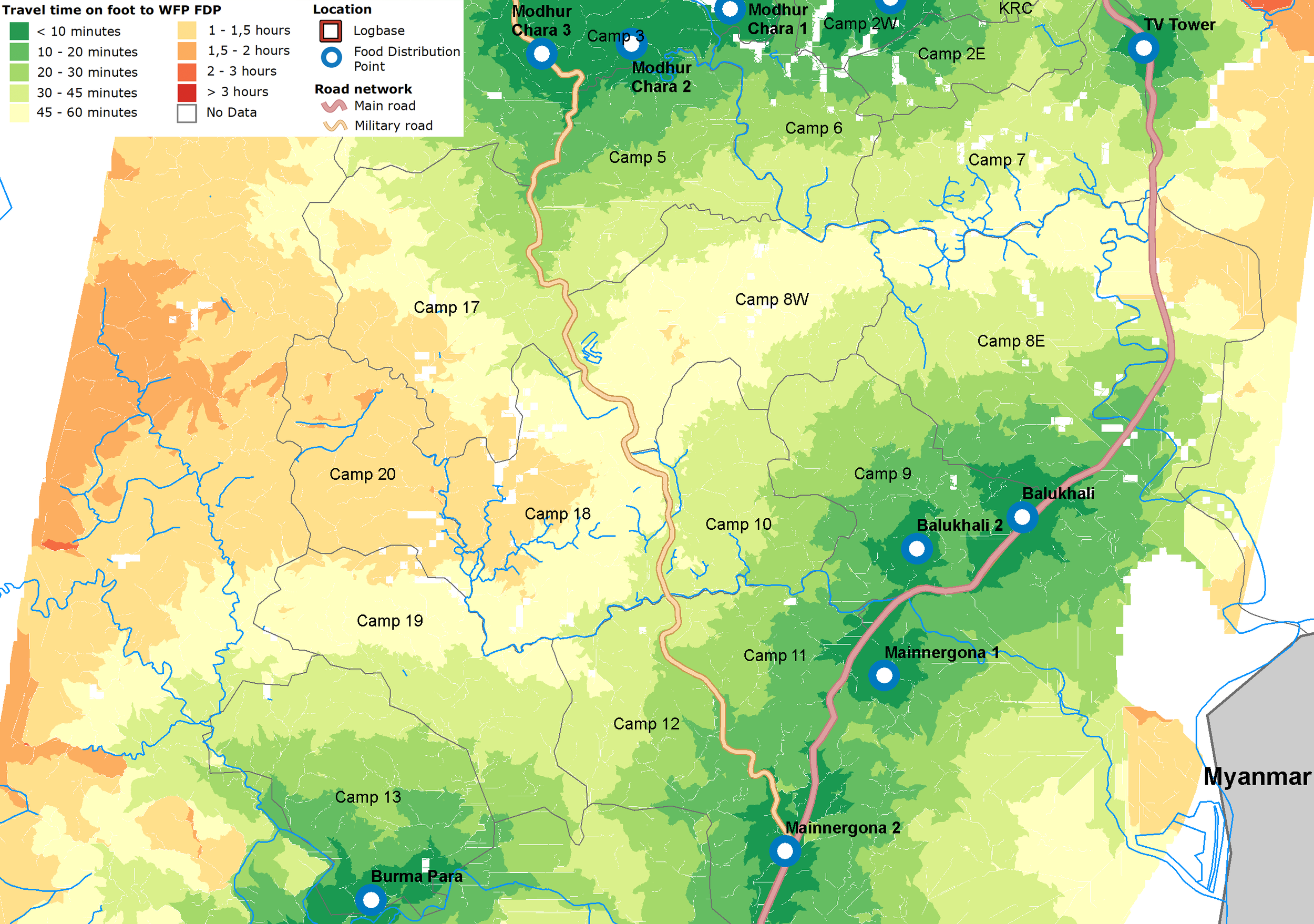
- FDP catchment, calculated using cost allocation tools, indicates that about 138,000 refugees at Camp 8W, 10, 17, 18, 19 and 20 currently rely on FDP Modhur Chara 1 - 3, FDP Balukhali 1 - 2 and Mainnergona 1 and 2. And around 25,000 refugees need approximately an hour to access the nearest FDP
- Further, WFP established FDP Balukhali 3 to provide closer access for 19,000 refugees in Camp 8W, 10, 17, 18, 19 and 20 with travel time approximately is less than an hour on foot.
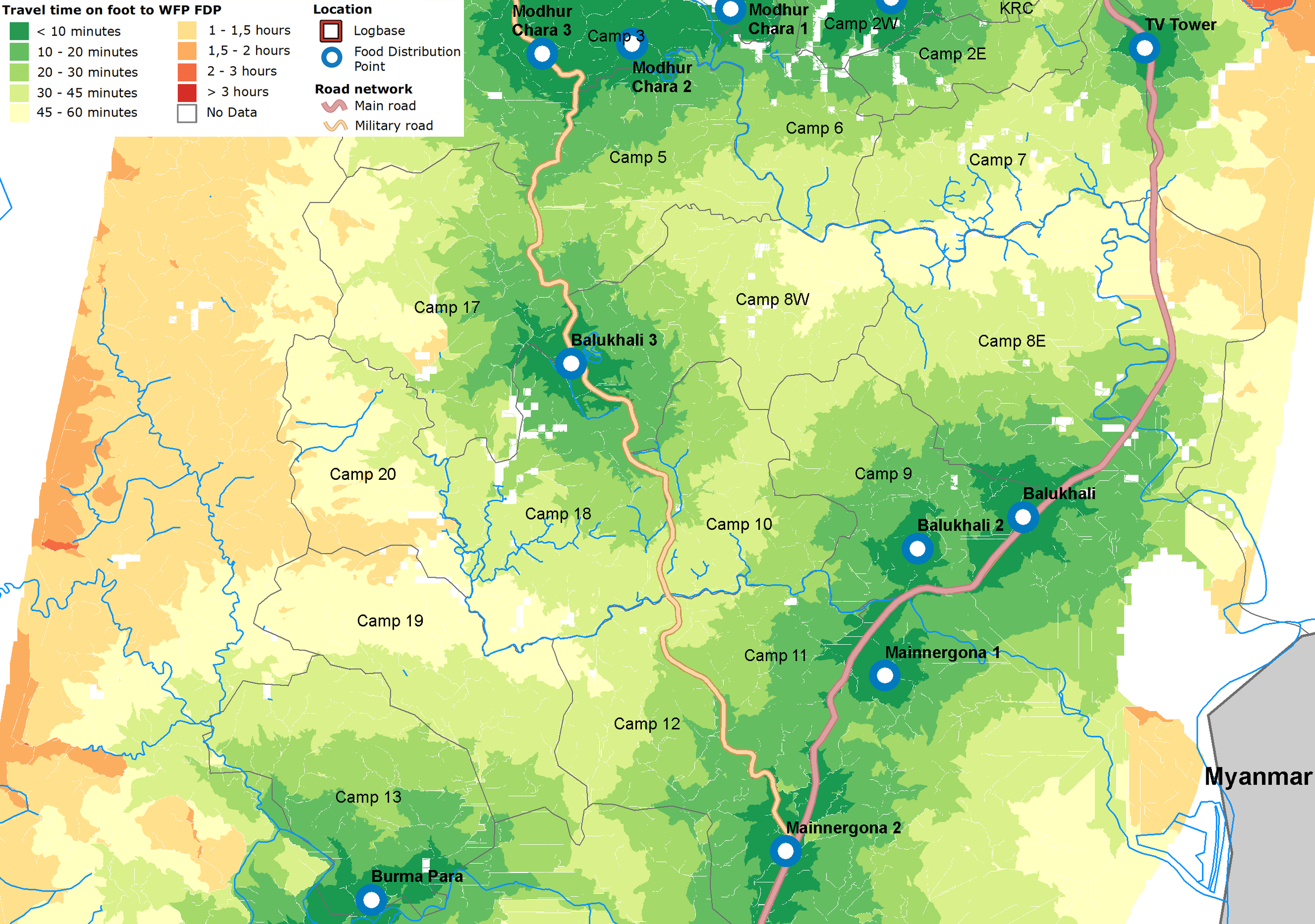
- They plan to establish new FDP at Camp 20 to serve and provide better access to refugees in Camp 19 and 20. Leaving around 1,700 refugees still have access more than an hour on foot.
Data:
- Food Distribution Point (WFP)
- Camps boundary (REACH and ISCG)
- Road and river network (OpenStreetMap)
- Shelter polygon (OpenStreetMap)
- Land cover (Global Land Cover 30)
- Surface water (JRC)
- Elevation (DSM from Drone provided by IOM and ISCG)