How to get daily rainfall forecast data from GFS? (Part 1)
Last week, Tropical Cyclone Seroja hit eastern part of Indonesia and Timor-Leste. It brought flood and landslide displaced more than 8,000 people and led to the deaths of 42 people in total in Timor-Leste. The storm also caused power outages in the entire country. In Indonesia, Seroja caused widespread rainfall and thunderstorms in Nusa Tenggara Barat and Nusa Tenggara Timur provinces, and trigger a flood and landslide in various areas.
Many questions arise on that day: What will happen tomorrow? How is the weather will be in the afternoon? Where is Seroja now?
Currently, it is quite easy to get weather and forecast information from internet or mobile apps. Lot of 3rd party company provide the forecast based on public data for free. You named it: Ventusky, Windy, Zoom, DarkSky, the most popular and influential one is earth.nullschool.net, a famous project by Cameron Beccario.
GIS-ready data
Sometimes you are looking for a daily rainfall forecast data in the area where the cyclone will pass. But you don’t understand on how to get the data and what data are available for public?
GFS
One of the best data related to weather forecast is Global Forecast System (GFS) data from NOAA. Below are some detail about GFS:
The Global Forecast System (GFS) is a weather forecast model produced by the National Centers for Environmental Prediction (NCEP).
The GFS dataset consists of selected model outputs as gridded forecast variables. The 384-hour forecasts, with 3-hour forecast interval, are made at 6-hour temporal resolution (i.e. updated four times daily).
TEMPORAL COVERAGE: from 15 Jan 2015 to nowadays (new version of GFS)
TEMPORAL RESOLUTION: 3h, 6h, 12h, 18h, 24h upto 16 days
SPATIAL COVERAGE: 90° N – 90° S
SPATIAL RESOLUTION: 0,25° x 0,25°
VARIABLE: 743 variable are available, full list: https://www.nco.ncep.noaa.gov/pmb/products/gfs/gfs.t00z.pgrb2.0p25.f003.shtml
FORMAT: GRIB2 (*.grib2), Reference: https://wmoomm.sharepoint.com/:b:/s/wmocpdb/EUmnLNAM9WdMr1S7GRMl_G8BFqp-B1Qie-k-vMwmrG22GQ?e=cEd2Vk
How to acquire the data?
In this case, I am interested to get 1 - 5 days Total Precipitation (APCP - code for total precipitation in GFS) data. There are several ways to get this data.
1. GRIB filter
GFS forecast data only available for the last 10-days and updated every 6-hours period. Accessible via this GRIB filter:https://nomads.ncep.noaa.gov/cgi-bin/filter_gfs_0p25.pl. If today is 13 April 2021, then GFS only available from 4 - 13 April 2021.
We will try to get forecast data issued on 13 April 2021, forecast hour 00.
Access GRIB filter link above: choose sub-directory gfs.20210413, 00, atmos
In combo-box, choose gfs.t00z.pgrb2.0p25.f006 (551063361); levels: surface; variables: APCP; sub-region: left longitude 94, right longitude 142, top latitude 7, bottom latitude -12.
Click Start Download, you will get grb file with name: gfs.t00z.pgrb2.0p25.f006
If you choose option Show the URL only for web programming, you will get URL information: https://nomads.ncep.noaa.gov/cgi-bin/filter_gfs_0p25.pl?file=gfs.t00z.pgrb2.0p25.f006&lev_surface=on&var_ACPCP=on&leftlon=94&rightlon=142&toplat=7&bottomlat=-12&dir=%2Fgfs.20210413%2F00%2Fatmos
Using above URL, we can modified and make automation script to download all data that we required.
Script for batch download
Example parameters
Forecast available every 6-hours, we will focus from f006 (start of data) until f120 (day-5)
Release hour (00, 06, 12, 18): geavg.t00z
Forecast hour (f006, f012, f018, f024, f030, f036, f042, f048, f054, f060, f066, f072, f078, f084, f090, f096, f102, f108, f114, f120): f006
Level: surface
Variable: APCP
Subset: Indonesia (94,142,7,-12)
Date (YYYYMMDD): 20210413
Release hour (00, 06, 12, 18): 00
Download process
Each time we run the download process procedure (Example: Date 3 Nov 2020, release hour 00), it means we need to download all the forecast hour from f006 to f120
…………….
…………….
When new forecast released (for example release hour: 06, 12 and 18), we need to repeat all download procedure above and adjust the script with current release hour.
2. NCAR/UCAR Research Data Archive
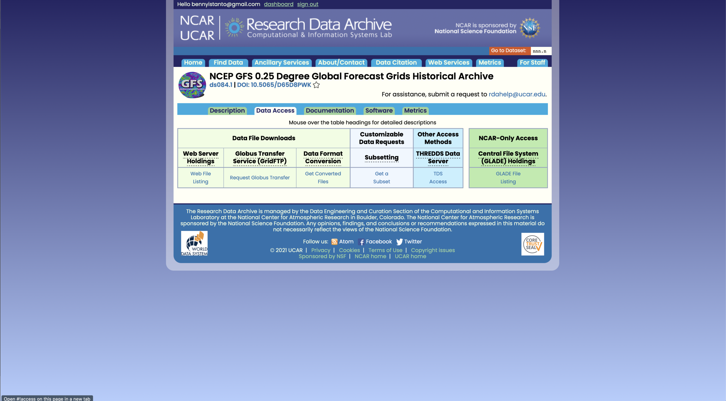
GFS data also available from NCAR/UCAR Research Data Archive portal: https://rda.ucar.edu/datasets/ds084.1/. If you don’t have account, you need to register in order to download the data.
Go to Data Access tab, Get a Subset
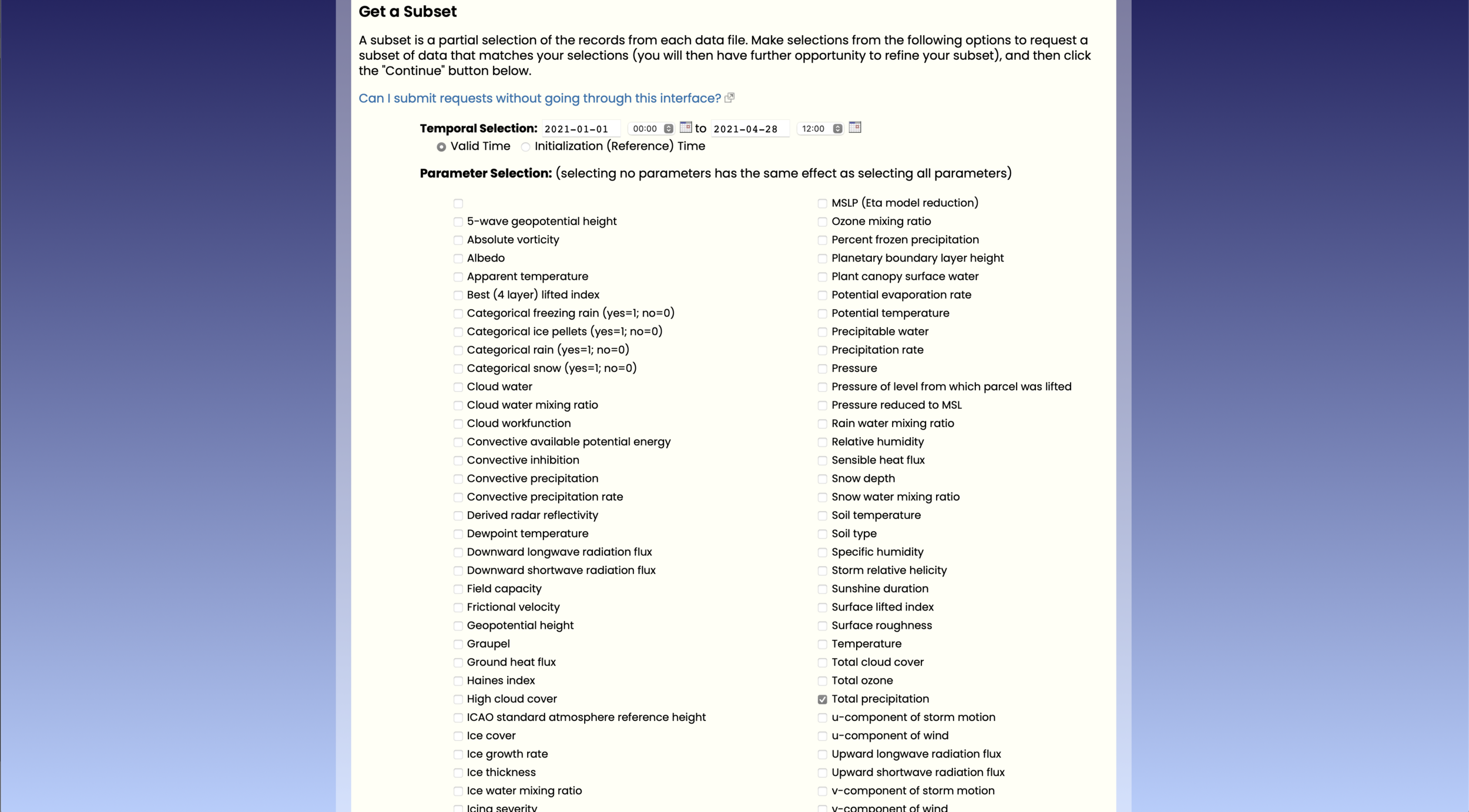
Choose temporal selection: 2021-01-01 00:00 to 2021-04-28 12:00
Parameter selection: Total Precipitation, Continue
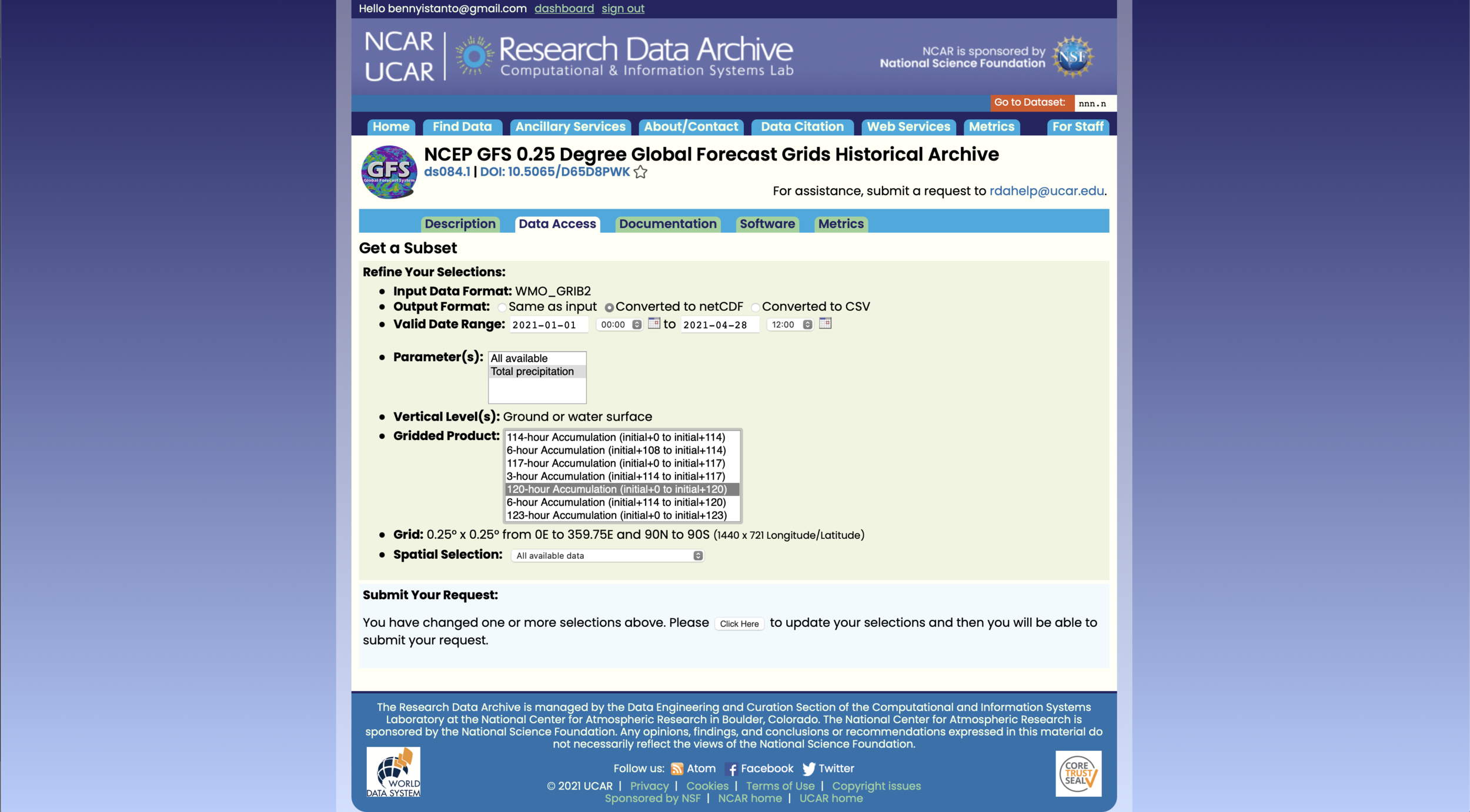
Output format: I prefer to have data in netCDF
In the gridded product, I choose 24-hour, 48-hour, 72-hour, 96-hour and 120-hour Accumulation
Spatial Selection: you can leave as it is, or choose within a bounding box. Continue with push Click here button
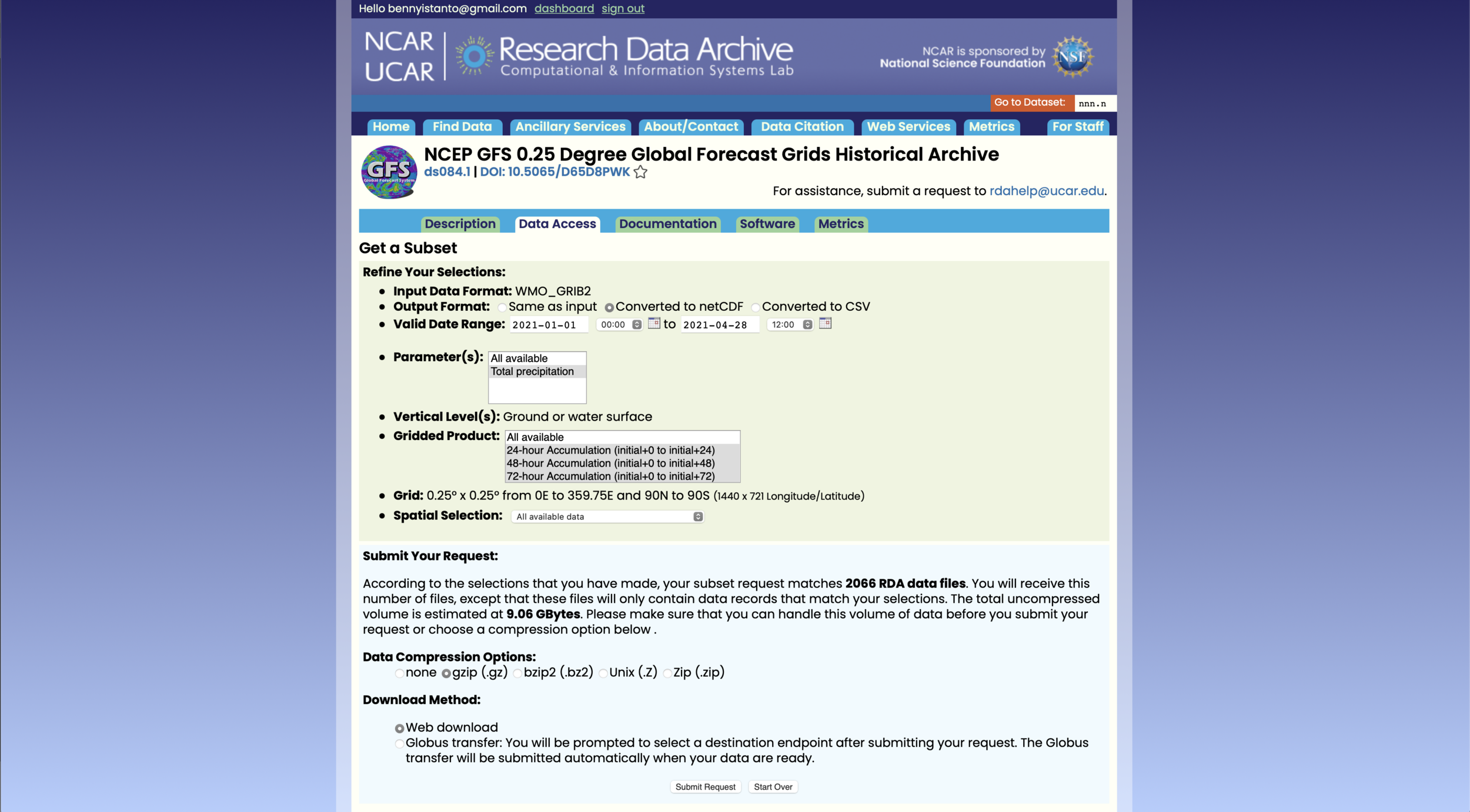
It’s optional to choose data compression option.
Submit request.


If the data ready to download, you will get an email.

