Province Infographic.
On 27 Nov 2014 at a national seminar in Jakarta - Indonesia National Disaster Management Agency (BNPB) and National Statistics Office (BPS) launched new publication on data for disaster management. The “Provincial Infographics” book was developed in cooperation with BNPB, BPS, and with technical support from several United Nations agencies, including UNFPA, OCHA, WFP and UNDP. This multi-stakeholder cooperation can be seen as an innovative way of using integrated data, collected from various parties for humanitarian purposes.
The infographics provide a fast and reliable reference for BNPB and other government, national and international actors working on policy planning and analysis for disaster preparedness and humanitarian response.
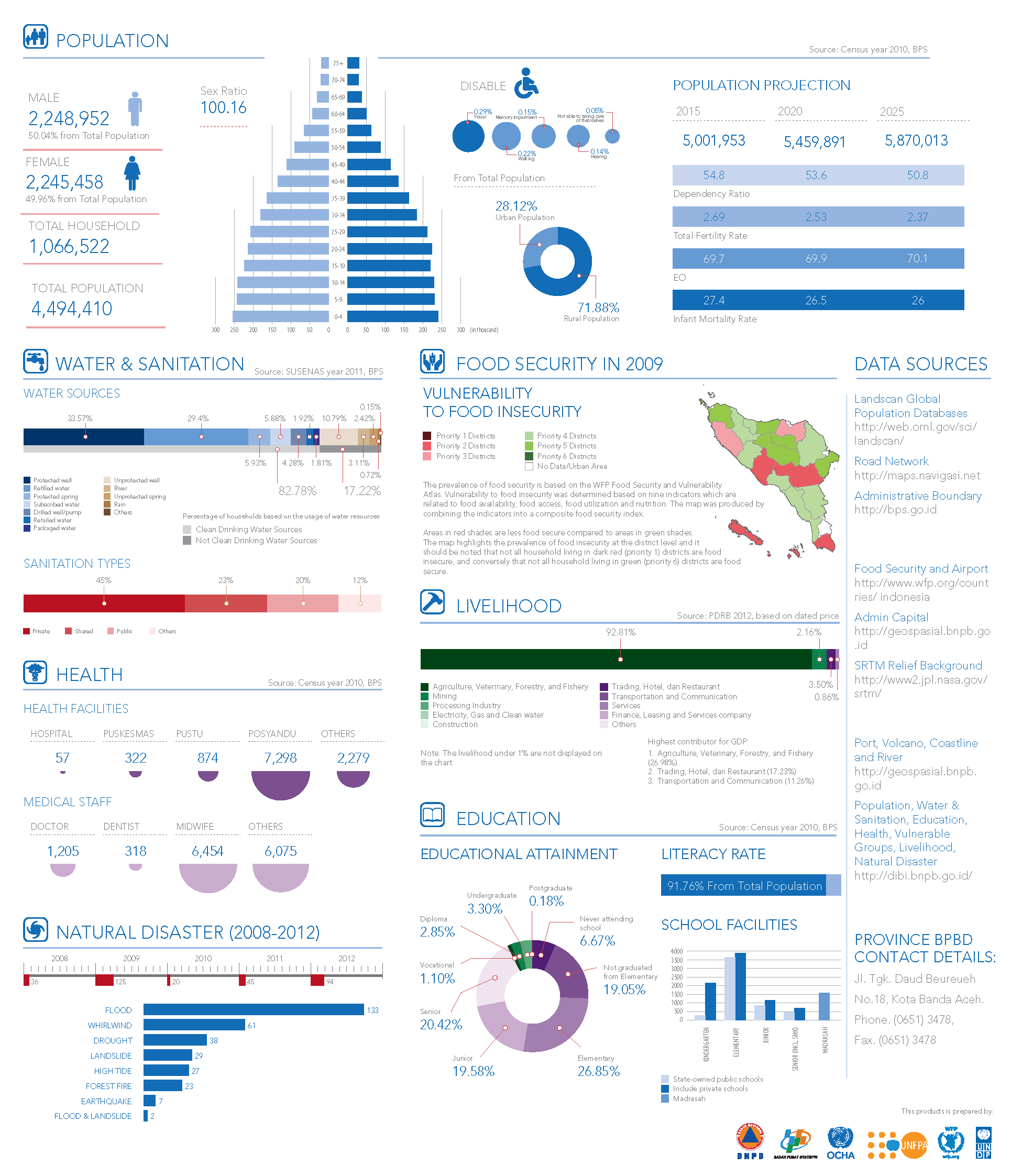
The book contains maps and graphics related to Indonesia’s provinces and their populations, with a focus on the seven main sectors of population, food security, livelihoods, education, health, water and sanitation and disasters.
You can find a copy of the book at this link:
Bahasa Indonesia - https://www.humanitarianresponse.info/sites/www.humanitarianresponse.info/files/documents/files/IDN_Province_infographic_BHS_27Nov2014.pdf
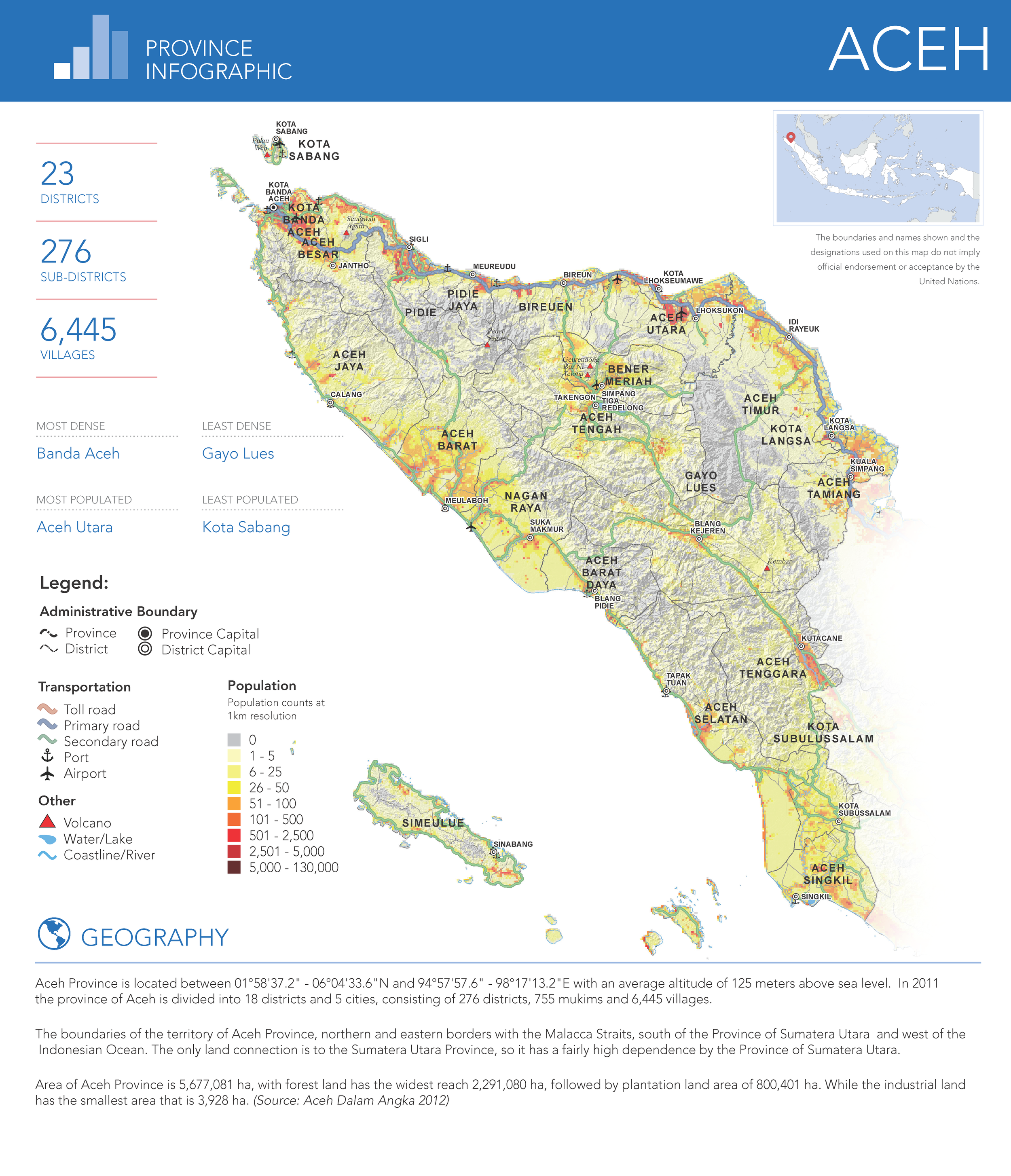
Below is an example of infographic from Aceh province.
Reference:
https://reliefweb.int/report/indonesia/indonesia-province-infographic-book-27-nov-2014
https://data.humdata.org/dataset/indonesia-province-infographic-datasets
Tools: ArcGIS 10.2.2, Illustrator, Tableau
Year: 2014
Team: Dikot Pramdoni Harahap, Suprapto, Ratih Nurmasari, Theopilus Yanuarto, Narwawi Pramudhiarta, Muhammad Rifat, Faizal Thamrin, Benny Istanto, Atik Widyastuti, Adi Kurniawan, Felix Yanuar


