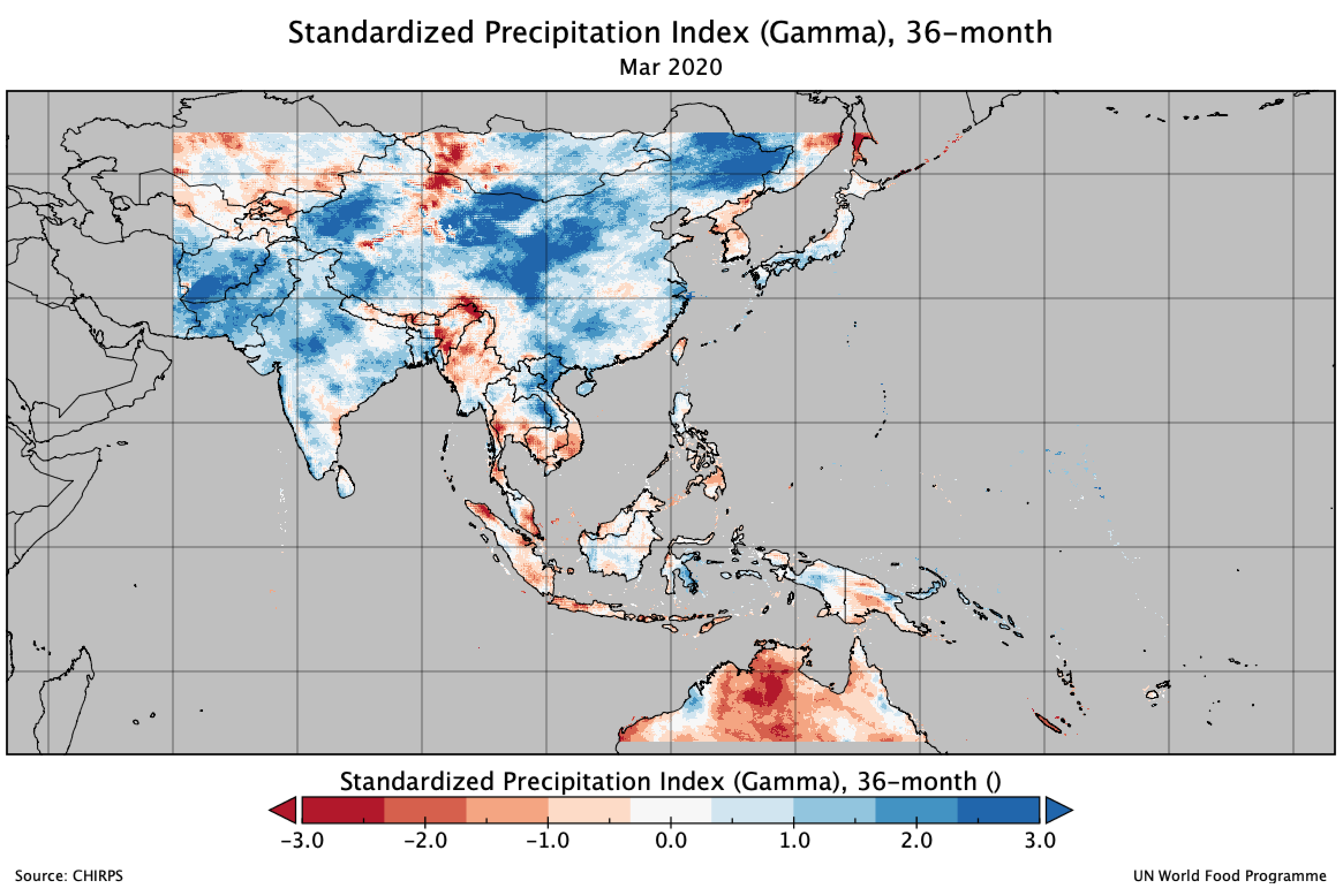
Standardized Precipitation Index.
About the data.
Data: CHIRPS and IMeRG
Reference:
Source:
CHIRPS https://data.chc.ucsb.edu/products/CHIRPS-2.0/global_dekad/tifs/
IMeRG https://gpm1.gesdisc.eosdis.nasa.gov/data/GPM_L3/GPM_3IMERGM.06/
Spatial resolution:
CHIRPS: 0.05 deg ~ 5.6 km at equator.
IMeRG: 0.1 deg ~ 11.1 km at equator
Temporal resolution:
CHIRPS: 1-month to 72-month, with rolling dekad
IMeRG: 1-month to 72-month, with rolling dekad
Coverage:
CHIRPS: 50N-23.5S, 60E-180E
IMeRG: 90N-90S, 180W-180E
Method:
SPI calculated using climate-indices python package, details and how-to guide available at blog post.
SPI Reference Guide from World Meteorological Organization: https://public.wmo.int/en/resources/library/standardized-precipitation-index-user-guide
Format:
GeoTIFF (*.tif)
Projection:
EPSG:4326
Data availability:
CHIRPS:
SPI-1mont: Dekad 3, Jan 1981 - Dekad 3, Mar 2021
SPI-2month: Dekad 3, Feb 1981 - Dekad 3, Mar 2021
SPI-3month: Dekad 3, Mar 1981 - Dekad 3, Mar 2021
SPI-6month: Dekad 3, Jun 1981 - Dekad 3, Mar 2021
SPI-9month: Dekad 3, Sep 1981 - Dekad 3, Mar 2021
SPI-12month: Dekad 3, Dec 1981 - Dekad 3, Mar 2021
SPI-24month: Dekad 3, Dec 1982 - Dekad 3, Mar 2021
SPI-36month: Dekad 3, Dec 1983 - Dekad 3, Mar 2021
SPI-48month: Dekad 3, Dec 1984 - Dekad 3, Mar 2021
SPI-60month: Dekad 3, Dec 1985 - Dekad 3, Mar 2021
SPI-72month: Dekad 3, Dec 1986 - Dekad 3, Mar 2021
IMeRG:
SPI-1month: Dekad 3, Jun 2000 - Dekad 3, Dec 2020
SPI-2month: Dekad 3, Jul 2000 - Dekad 3, Dec 2020
SPI-3month: Dekad 3, Aug 2000 - Dekad 3, Dec 2020
SPI-6month: Dekad 3, Nov 2000 - Dekad 3, Dec 2020
SPI-9month: Dekad 3, Feb 1981 - Dekad 3, Dec 2020
SPI-12month: Dekad 3, May 2001 - Dekad 3, Dec 2020
SPI-24month: Dekad 3, May 2002 - Dekad 3, Dec 2020
SPI-36month: Dekad 3, May 2003 - Dekad 3, Dec 2020
SPI-48month: Dekad 3, May 2004 - Dekad 3, Dec 2020
SPI-60month: Dekad 3, May 2005 - Dekad 3, Dec 2020
SPI-72month: Dekad 3, May 2006 - Dekad 3, Dec 2020
Date structure:
YYYY.MM.D
YYYY = Year
MM = Month
D = Dekad (1, 2 and 3). Dekad 1 = 1 - 10, Dekad 2 = 11 - 20, Dekad 3 = 21 - 28/29/30/31
Example: 2020.12.2.spi6.tif = SPI-6month as of 20 Dec 2020.
Download.
SPI 1-month.
CHIRPS
Regional:
Indonesia:
IMERG
Global:
SPI 6-month.
CHIRPS
Regional:
Indonesia:
IMERG
Global:
SPI 24-month.
CHIRPS
Regional:
Indonesia:
IMERG
Global:
SPI 60-month.
CHIRPS
Regional:
Indonesia:
IMERG
Global:
SPI 2-month.
CHIRPS
Regional:
Indonesia:
IMERG
Global:
SPI 9-month.
CHIRPS
Regional:
Indonesia:
IMERG
Global:
SPI 36-month.
CHIRPS
Regional:
Indonesia:
IMERG
Global:
SPI 72-month.
CHIRPS
Regional:
Indonesia:
IMERG
Global:
SPI 3-month.
CHIRPS
Regional:
Indonesia:
IMERG
Global:
SPI 12-month.
CHIRPS
Regional:
Indonesia:
IMERG
Global:
SPI 48-month.
CHIRPS
Regional:
Indonesia:
IMERG
Global:


